


Hintersteinersee

Geert H.
User
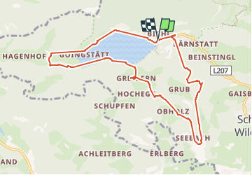

Length
9.6 km

Max alt
935 m

Uphill gradient
376 m
Km-Effort
14.6 km

Min alt
686 m

Downhill gradient
370 m
Boucle
Yes
Creation date :
2022-09-10 08:00:20.856
Updated on :
2024-09-22 08:11:50.811
1h06
Difficulty : Medium

FREE GPS app for hiking
 SityTrail
IGN / Geographical institutes
SityTrail Plus
The world is yours!
About
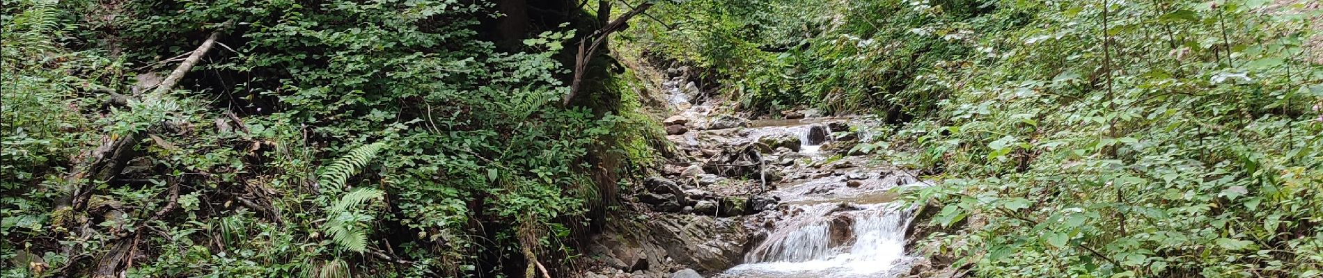
Trail Walking of 9.6 km to be discovered at Tyrol, Bezirk Kufstein, Gemeinde Scheffau am Wilden Kaiser. This trail is proposed by Geert H..
Photos


21 photos in total. Please click on a photo to see them all in the gallery.
Positioning
Country:
Austria
Region :
Tyrol
Department/Province :
Bezirk Kufstein
Municipality :
Gemeinde Scheffau am Wilden Kaiser
Location:
Unknown
Start:(Dec)
Start:(UTM)
291082 ; 5269179 (33T) N.
Comments